Rudgear Road connections
Which neighborhoods use Rudgear Road between Vanderslice Avenue and South Broadway to reach the Iron Horse Trail or Murwood Elementary? These maps show locations whose fastest modeled bicycle route uses this stretch of Rudgear.
Click either map to inspect a route. Open the map's details for the legend and sampling settings, or turn on sample locations to see the points used in the analysis.
To the Iron Horse Trail
About 1,800 homes would use this stretch of Rudgear to get to the Iron Horse Trail. This is an estimate of housing units, including apartments and vacant homes.
How we estimated homes · Download the estimate and source details
How boundary assumptions affect the estimate
Assigning parcels by majority of their area gives about 1,800 homes. Counting only wholly contained parcels gives about 1,600; including every touching parcel gives about 1,900. The last rule can include whole apartment complexes with only small overlaps. These are different boundary rules, not confidence intervals.
The purple area shows locations whose route to a connected trail entrance uses the orange Rudgear corridor.
Open the trail map on its own · Download the trail catchment GeoJSON
To Murwood Elementary
About 550 homes would use this stretch of Rudgear to get to Murwood Elementary. This is an estimate of housing units, including apartments and vacant homes.
How we estimated homes · Download the estimate and source details
How boundary assumptions affect the estimate
Assigning parcels by majority of their area gives about 550 homes. Counting only wholly contained parcels gives about 470; including every touching parcel gives about 1,100. The last rule can include whole apartment complexes with only small overlaps. These are different boundary rules, not confidence intervals.
Within Murwood Elementary's attendance boundary, which locations use the same Rudgear corridor to get to school? This map compares routes to the school's two configured entrances. The dotted line shows the attendance boundary; purple shows the modeled catchment for this stretch of Rudgear.
School grounds are excluded because those locations are already at school. Street access stays on the same side of South Broadway as the sampled origin, so a click east of Broadway cannot start on the trail across the road. Routes can still use mapped crossings. These are possible trip origins, not a count of students or observed school trips.
Open the Murwood map on its own · Download the school catchment GeoJSON
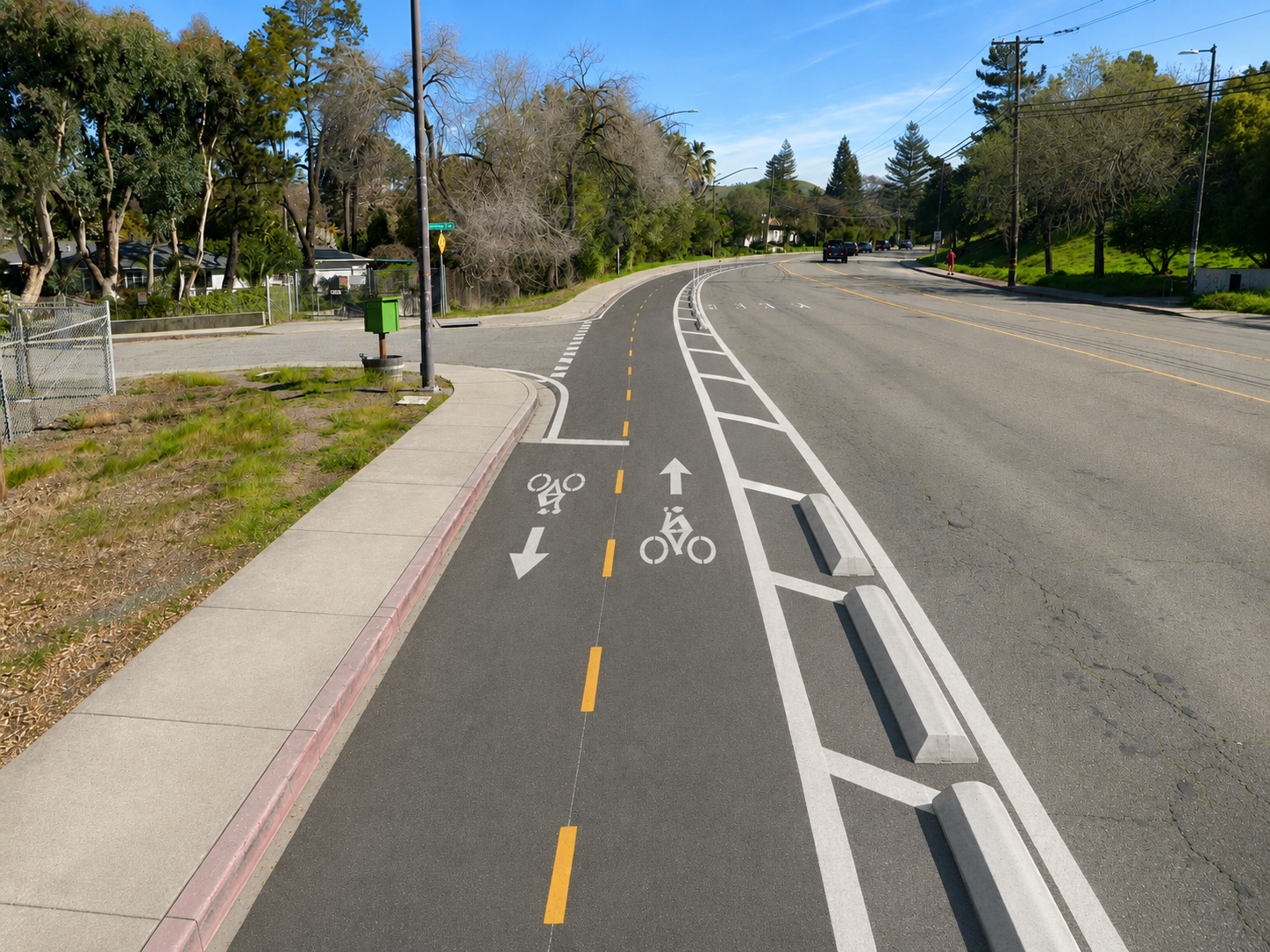
A safer connection to the trail and school
Our proposal is a two-way protected bike lane connecting Vanderslice Avenue and South Broadway.
About the models
Both maps use the same bicycle routing model with local road and crossing penalties. The trail map compares connected trail entrances; the school map compares Murwood's configured entrances. Times are modeled minutes, including routing penalties. They are not measured journey times.
The analyses sample locations near roads on a 37.5-yard grid. The boundaries fill open-space gaps between qualifying locations; they do not imply that there is a path across that land. Samples represent locations, not counts of homes or people. Clicking chooses a nearby sampled origin. The popup reports its distance from your click; in the school map, it also shows the distance to the actual network route start. That access distance is outside the modeled time. If there is no nearby sample on your side of Broadway, the school map says so instead of using a point across the road.
Some private residential streets are missing from the current bicycle router, including the interior of Stonecastle Estates. They can be inside the Murwood attendance boundary while remaining unsampled. Shading there is inferred from nearby sampled roads. The housing estimates describe the published purple zones, including this coverage limitation; they do not count every home in the school attendance area.
The published routes are saved with the analyses. Clicking either map does not recalculate routes using current road conditions.
How we estimated homes
We combine Contra Costa County assessment parcels with 2020 Census block housing totals. Residential parcel types help allocate each block's housing total to the shaded zone. A parcel belongs to the zone when a point inside that parcel falls within the shading.
These are 2020-based housing estimates, allocated using county parcel data. The downloadable reports record source retrieval dates. A home means a housing unit: a house, apartment, townhouse, or condominium, including vacant units. The estimates are separate from the routing sample counts and are not counts of enrolled students or school trips.
Parcels cut by the boundary introduce uncertainty, especially large apartment complexes. The downloadable reports compare interior-point, centroid, majority-area, wholly contained, and any-overlap rules. Counting every touching parcel can include a whole complex even when only a small part of its grounds intersects the zone. Those comparisons are boundary scenarios, not confidence intervals. Large apartment complexes share the housing weight left in their Census block after other residential properties are accounted for; these are allocation assumptions, not verified unit counts for individual complexes.
Embed these maps
Paste either iframe into your website. Its width follows the surrounding page; you can adjust the height.
Trail access
<iframe
  src="https://walkbikewc.com/maps/rudgear/"
  title="Rudgear Road access to the Iron Horse Trail"
  width="100%"
  height="650"
  loading="lazy"
  style="border:0">
</iframe>
Murwood Elementary
<iframe
  src="https://walkbikewc.com/maps/murwood-rudgear/"
  title="Bicycle routes to Murwood Elementary via Rudgear Road"
  width="100%"
  height="650"
  loading="lazy"
  style="border:0">
</iframe>